So this year, I decided to go back there with Katy in tow and see some more stuff. The major attraction for me is the network of refuges run by the Club Alpin Francais. If you follow the link to Alpes du Sud you can see the refuges they maintain in the park. These are basically catered hostels offering dormitory accomodation, breakfast, dinner (and a packed lunch if you wish) for walkers. They are much better than camping, because they are more robust to the very variable weather, and they mean you don't have to carry tent and food along with you. You can book these in advance on their website, and I booked them all this time, but it was not necessary as it happens. I went during the second last week in September, which is definitely off-season. It wasn't necessary the last time I was there either. For someone who isn't a member of CAF, they cost around 40 euro per person per night including dinner, breakfast and packed lunch.
We walked from Casterino to St.-Martin-Vesubie following this route (click for larger versions):
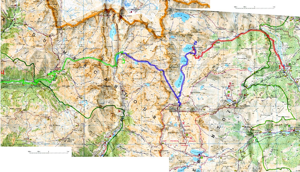
This was patched together from IGN maps 3841OT and 3741OT which cover a lot more than this.
The first obstacle to overcome on this kind of holiday is how to get to the start! Not so easy in this case. Casterino is probably the most accessible village to start from.
To get to Casterino get a train to St Dalmas de Tende (from Nice for example). There are train times here (be careful, St Dalmas de Tende is not really mentioned on the main SNCF website). From St Dalmas de Tende get a bus or a taxi to Casterino. The bus only runs on a timetable from June until August (ligne 923 Tende/Casterino: tel: 04 93 04 73 71) . The rest of the year, there is a bus-on-demand service which you have to reserve by telephone the day before (tel: 0 800 06 01 06). Reservations must be in by 5pm and will only be accepted for weekdays between 9am and 5pm. If you're lucky enough that your schedule allows you to get a bus, it only costs one euro. The alternative is a taxi. Taxi Franck (tel: 04 93 04 62 92/06 86 16 22 94) is based in nearby La Brigue and he will take you up there for 40 euro approx. You also have to book the taxi in advance, as St Dalmas de Tende is a real dump. Don't expect a taxi rank at the station. There is a really massive old ruined building beside the station which Taxi Franck told us was built by Mussolini so he could visit his mistress, who lived in St Dalmas de Tende!
We spent a night in Casterino, and on day one we walked from there to the Refuge de Valmasques (red route on map). I had stayed here before, and done a great circular walking route from there. We got there in about 3 or 4 hours after a leisurely, sunny, marmotty walk, featuring large herds of cows with massive cowbells. However, as soon as we arrived, the mist descended, and it started to rain, so we stayed put, drank spiced wine and played a lot of cards.
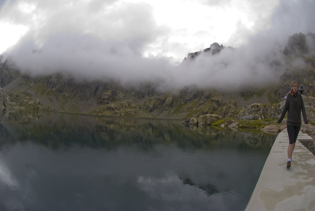
The weather cleared up a lot for the next morning:
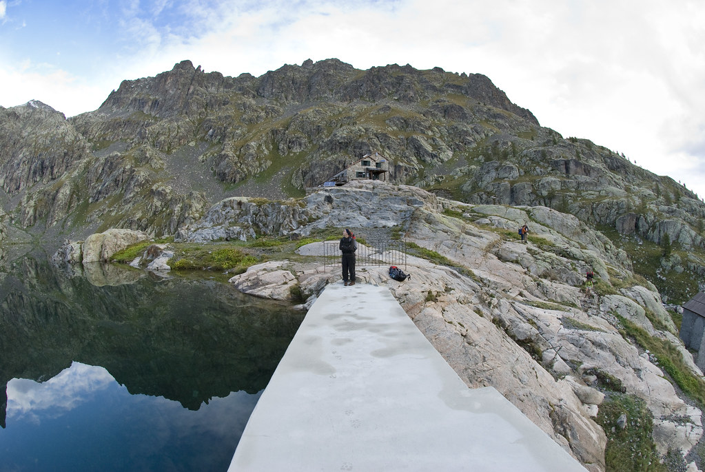
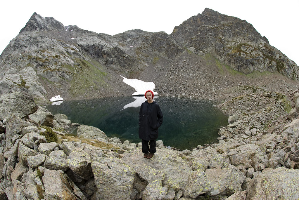
And so we marched on towards the Refuge de Nice (blue route). I misread the map a little and we took an accidental detour to the Baisse de Valmasque, but we got a great view of the Vallee des Merveilles:
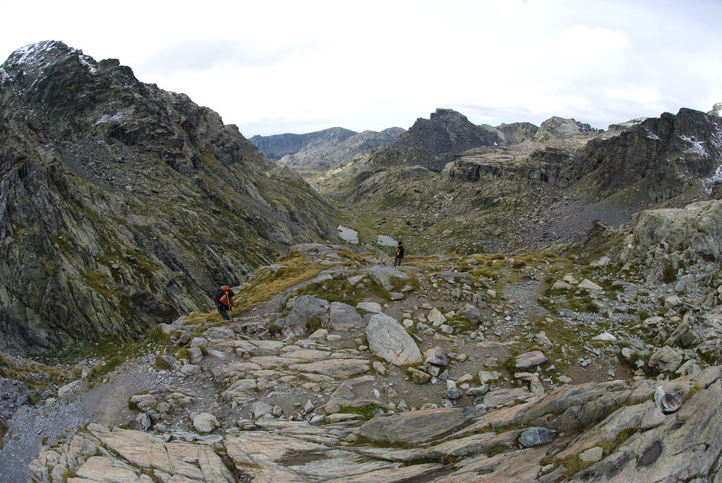
We were very surprised to go over the next pass (Baisse du Basto) to be greeted by knee deep snow on the other side:
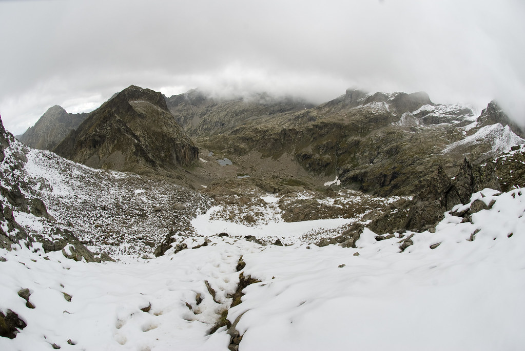
We were not really prepared for that either psychologically or equipmentually, but we made it down anyway. That was a little scary, particularly as it started snowing on our heads at one point. It was a relief to get to the Refuge de Nice after about 5 hours trekking. It was really very cold, and we had been walking for a long time, so we had showers, got into dry clothes, and spent the rest of the day sleeping and eating. The Refuge de Nice is newly refurbished, and quite fancy.
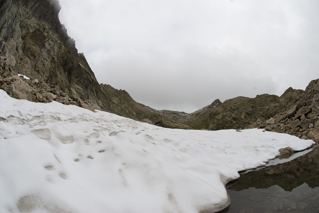
Next day we headed off towards the refuge at Madone de Fenestre (green route). It was a pig of a day, with heavy rain, however faced with the alternative of spending a whole day playing cards and reading, we decided to haul on the wet gear and go for it. There was a long section marked as "difficult hiking" on the map. This means, no path, just markers painted onto rocks, and clambering over rocks for several miles. In the cold, wind and rain. With occasional glaciers to cross (!) and a small cliff to scale at Pas du Mt Colomb, backpacks and all, without ropes. Alpine walking sticks would not have gone astray.
Finally we got to the refuge, changed into dry clothes and ate some myrtle tart and assorted other things, which made me feel about a hundred times better. So much so that we thought we could just skip staying the night there and march (on road!) down to St Martin de Vesubie (about 10km away). As we walked downhill, the weather cleared, we peeled off layers, and it was quite pleasant in the end.
We spent the night there and got the bus the next day to Nice. Be warned, there are only two buses a day, one at 7:30am and another at 1:30pm. It's a pretty town though, with lots of steep, windy cobbled alpine streets. We had some great food after the more basic grub from the refuges, and drank a lot.
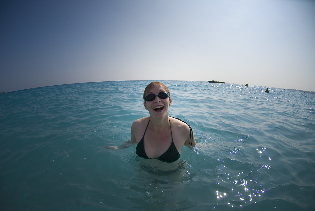
Finally we made it to the beach:
Even with the bad weather in the mountains, it was really enjoyable. The scenery was incredible. I've used a wide-angle lens this time to capture the panorama as best I could, without much success. There are many more photographs from the trip here. The route was great, but definitely difficult. We were pretty satisfied at being physically able to do it, it was rewarding to see the geology microclimate and plant life vary so rapidly as we walked the full width of the park.